
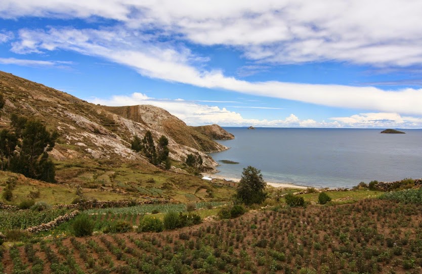
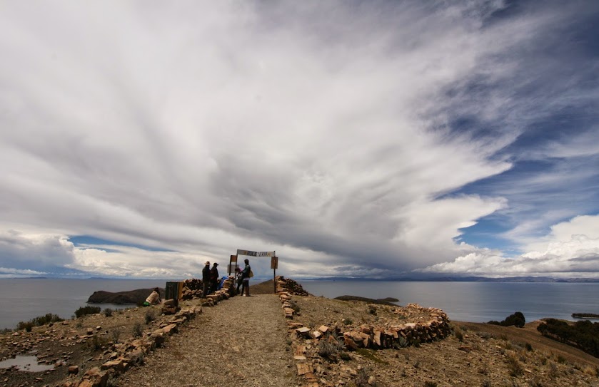
It was a tough decision whether or not to go to Isla del Sol, on Lake Titicaca. The weather seemed to be mostly bad. We watched some rain storms from our luxurious accommodation in Copacabana, and then heard them continue on the windows for most of the night. Would we really decide to get on a boat in the morning and head for the north end of the island? Where we would then risk hiking 4 hours back to the south end to stay the night – in questionable rain gear (one year of travel has really put a dent in the waterproof-ness of our jackets)? Well, the answer had to be yes.
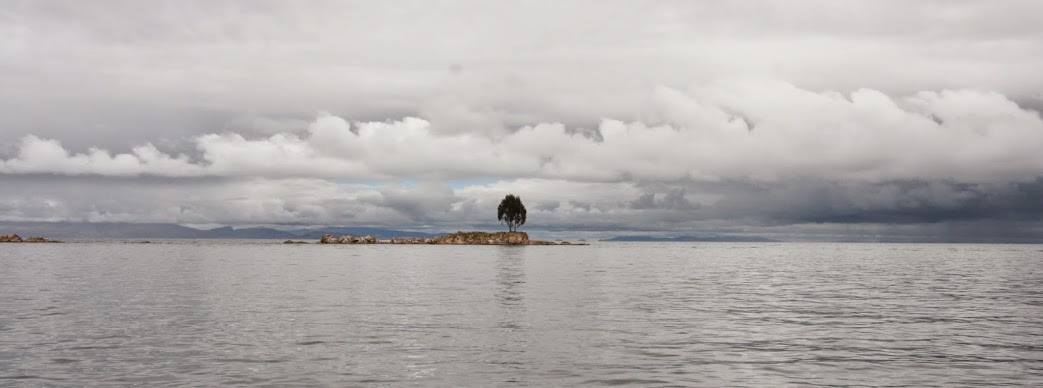
After leaving the south port of the island, the captain asked everyone riding on top of the boat to get down below, as he was pretty sure it would start raining. Sure enough, less than 5 minutes after restarting our journey it started to come down hard. We disembarked in Challapampa, and ran for cover in a crowded restaurant. The general chatter was concerning the weather, and when the next boat left to return to the south port… Luckily, after about 30 minutes, the skies started to clear. Another 30 minutes of hiking and we were stunned at our change in fortune – blue skies and beautiful clouds.


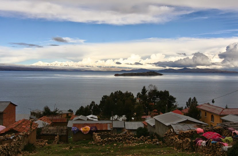

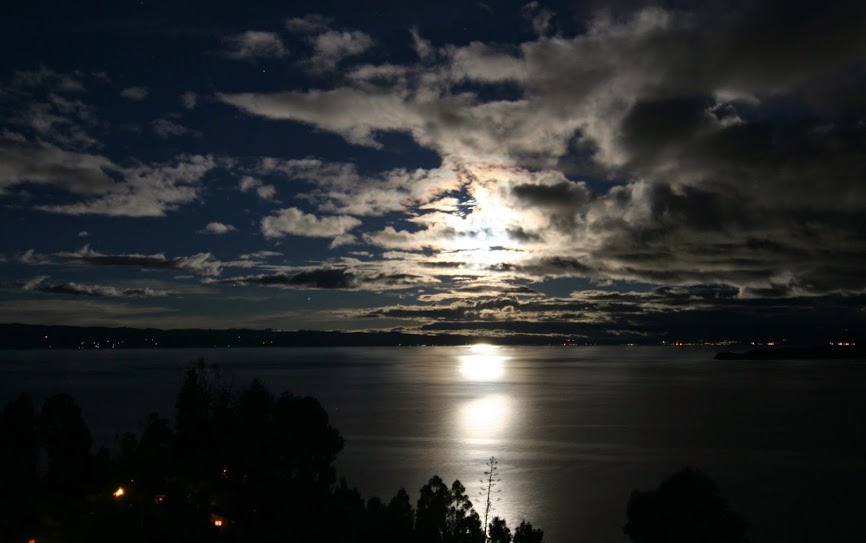
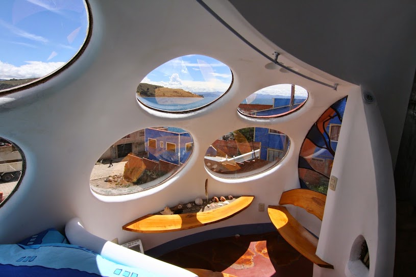
We stayed in this incredible place in Copacabana, Bolivia, on the shores of Lake Titicaca. I’m not sure I’ve ever stayed somewhere more interesting – it was too bad we only got one night.


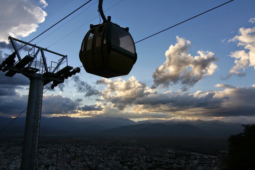
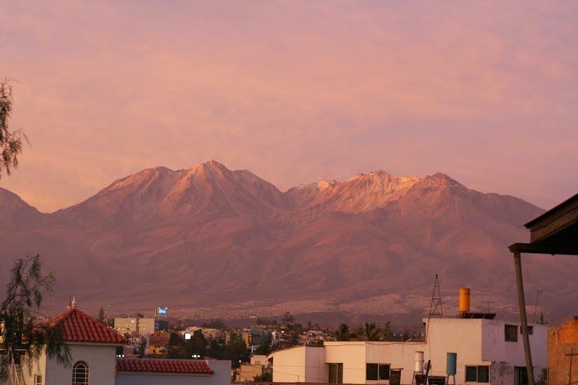
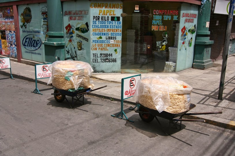
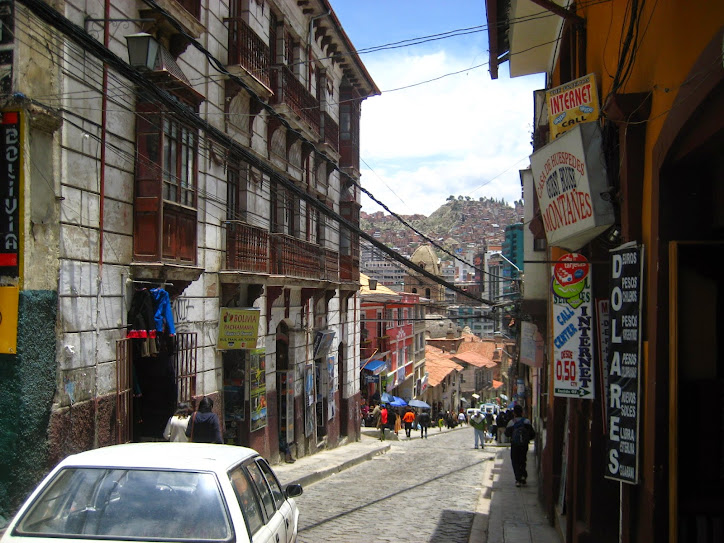
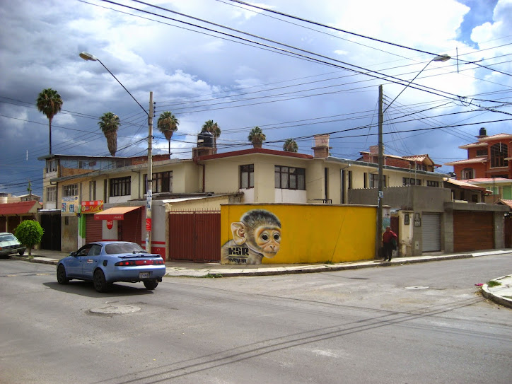
Things haven’t improved a lot since we arrived in La Paz. For one, the weather has been horrible – raining and cold. And the altitude has just been kicking ass against Sheena and I – sigh, what’s new? But during those rare times when we felt healthy enough to go for a walk, and it wasn’t coming down in buckets, La Paz has impressed me (can’t say if Sheena feels the same). The way the city has been constructed, cascading down canyon walls, is hard to comprehend. The very new, and very popular cable car system has been a nice way to get above the rooftops and see the cityscape. It’s a place I imagine that I would enjoy quite a bit, if it was slightly lower in elevation and a little bit warmer.


People from Cochabamba are called cochabambinos, which I find hilarious as it reminds me of The Sand Lot. They’re lucky enough to live in a great city – one of those medium sized South American cities that not too many backpackers visit. It reminds me of Manizales, Colombia, or maybe Salta, Argentina. Perhaps that’s just the cable car talking though… I still can’t believe how popular these things are down here.

We’re back up at elevation, having climbed about 2,000 meters in one of the shortest flights imaginable. I mean, I guess all they really had to do was reach cruising altitude and then land the thing – which they did pretty haphazardly. We had enough time to chug our drink and eat our cookies before returning everything to their upright position.

This stop is really just to gather our high altitude legs, before heading further north to La Paz. With 11 months under our belts, it’s hard to believe everything is ending (relatively) soon – my Calendar’s four week look-ahead shows California, USA. But it’s not done yet and we’re feeling very happy that we’re within sight of familiar territory (Arequipa, Peru is only 20 hours by bus; Arica, Chile only 10 hours). Here’s looking forward to the fresh juices and papa rellenas in Arequipa’s central market!

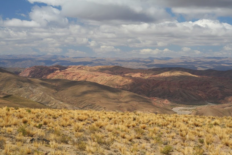
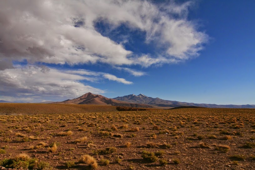
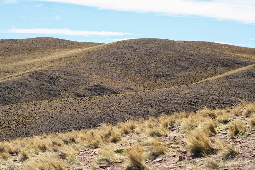
Here are a few more photos for your viewing pleasure. Scenery on Day 1 seemed to be mostly high plateau rolling hills. It was pastoral with beautiful clouds.
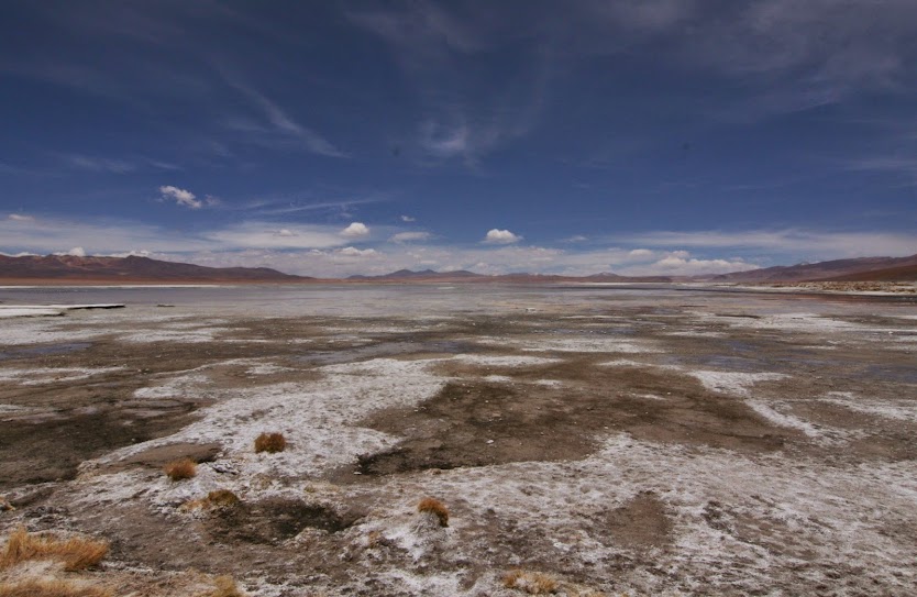
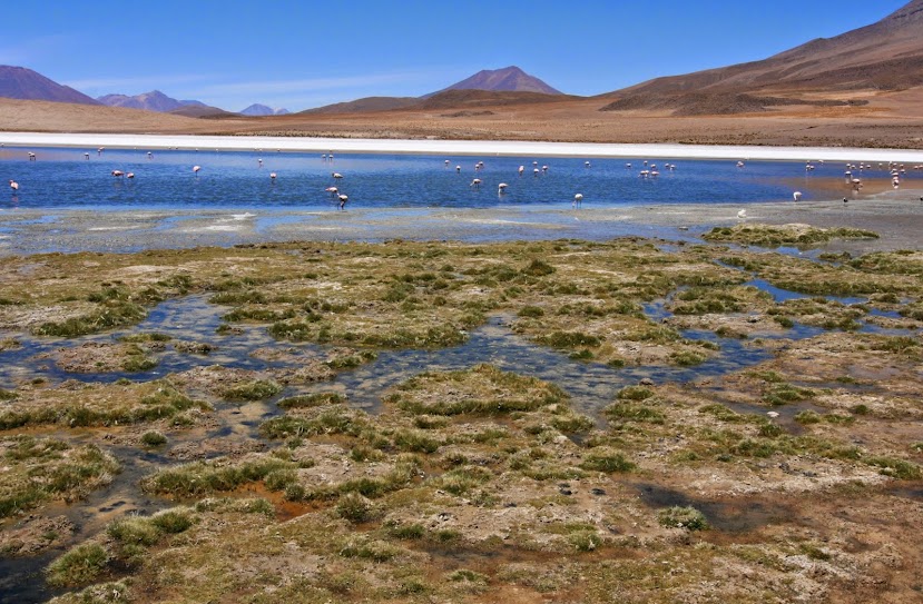
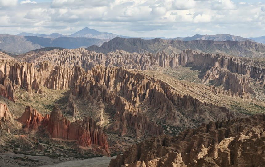
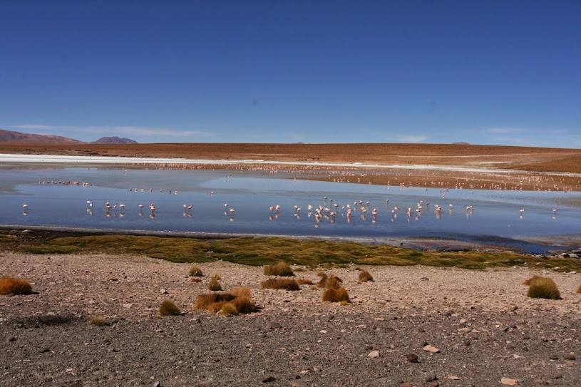
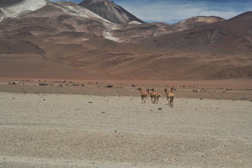
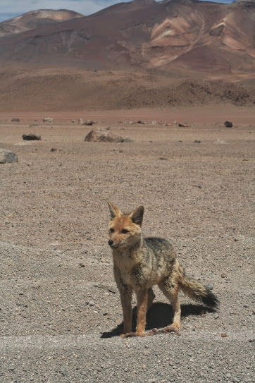
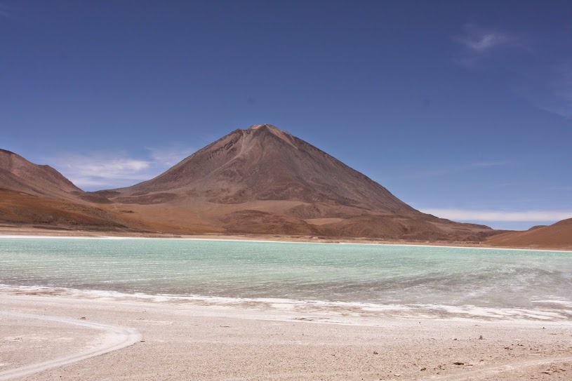
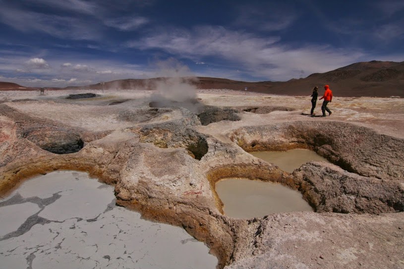
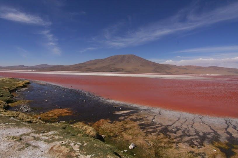
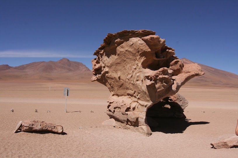
Day 2 and 3 were almost exclusively about lagoons, and strange looking ones at that. Islands of salt and borax dotted multi-colored bodies of water on the high plateau. Mountains with melting color completed the surreal landscapes.

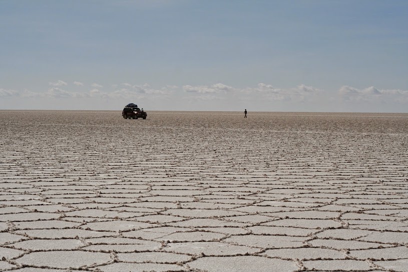
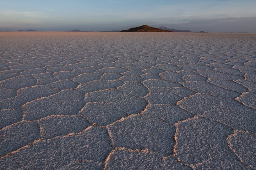
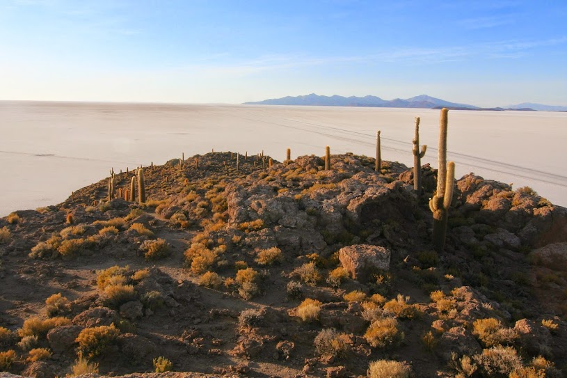
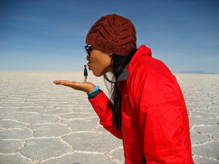
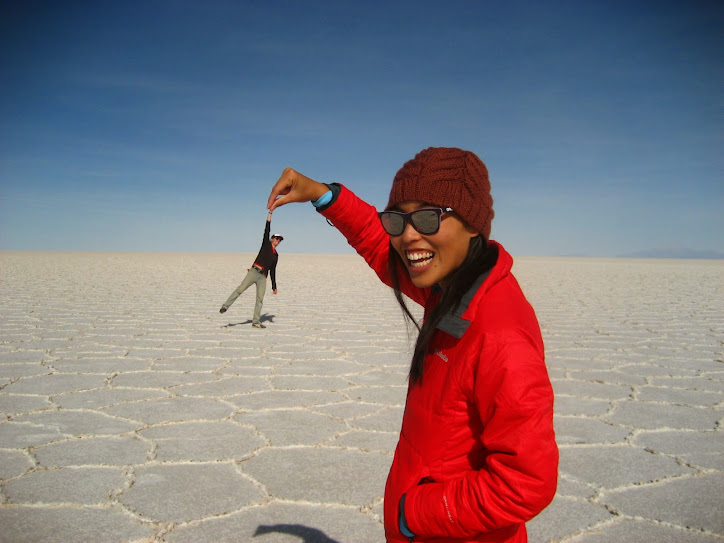
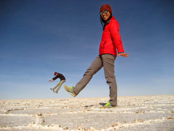
And the last day was focused on the huge expanse of the Uyuni Salt Flat. As the sun rose, the flat seemed more like a desert, or a giant frozen lake, than anything else.
Craig did the tour from San Pedro de Atacama, Chile seven years ago, so we were looking to do it a little differently this time around. We decided to go from Tupiza (just a couple of hours across the border from Argentina), which would take 4 days/3 nights instead of the 3 days/2 nights that most other tours consisted of. It cost a bit more (1,300 Bs, about $185 USD, plus 211 Bs, or $30 USD, in added fees), but we’re nearing the end of our trip here and the rest of Bolivia should be relatively cheap, so… why not?! Everybody else was doing it.
Day 1 – Getting to know you
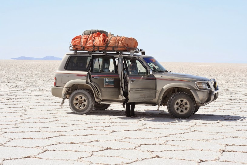
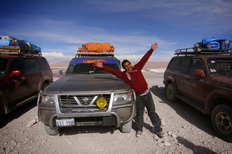
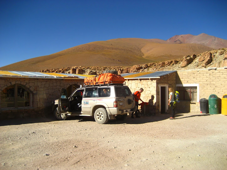
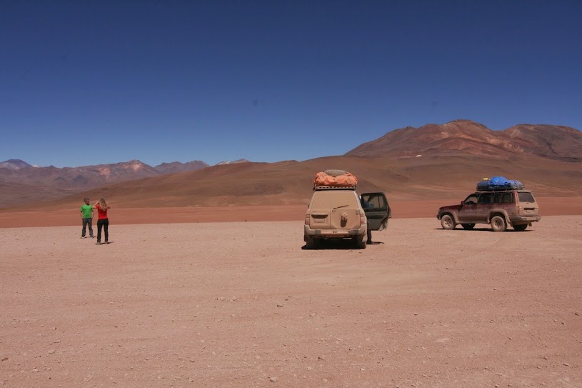
We shared our jeep with the driver, Jhon (not a misspelling), the cook, Hilda, and a couple from Munich, Maria and Felix. We’d heard of some horror stories of terrible camaraderie on tours, which we were hoping to avoid. Being stuck in a small, confined space for hours at a time with people you don’t like hardly sounds fun, right? Luckily, Maria and Felix, as well as Jhon and Hilda, turned out to be great people, which was a huge blessing later on in the trip, as you will see.
Throughout the day, we were pleasantly surprised by the quality of the tour (booked through La Torre in Tupiza). Jhon spoke only Spanish (English-speaking guides cost extra, so we translated for the Germans), but was very informative and helpful. Hilda gave us delicious food, which we’ve heard is not always the case on these tours. Accommodation was basic (no showers, shared dorm rooms), but clean and comfortable.
The only downside to that first day was going from 2,975 m (9,760 ft) to 4,855 m (15,928 ft), our highest point of the day. Craig became decommissioned for a few hours as he struggled to regain his equanimity, despite chewing industriously on the local remedy around here, coca leaves. In fact, everybody was feeling a little out-of-sorts that night, since we were sleeping at 4,150 m (13,615 ft), and I liberally dispersed my supply of acetazolamide around to good effect. In case you’re not aware, the safe thing to do is to ascend at less than 400 m per day–we were doing more than triple that. Altitude sickness is like being really drunk (dizzy, not in control of your body, stupid) and hungover (nauseous, fatigued, headache-y) at the same time. It’s no fun and is surprising how deeply it can affect you. I’m constantly taken aback by how awful you can feel just from being a few thousand more feet in the air.


We ended our six-week sojourn in Argentina with a few days in very small towns near the border with Bolivia. It was sad to leave our road-trip buddies, Johnny and Ellen, who could have been horrible company for four days in a small car, but ended up being totally awesome people. Whew! We heard of some road trip horror stories, so I’m glad we dodged a bullet there.

Our next stop after resting for a day in Salta was Humahuaca, a very small town at 2,940 m (9,645 ft). Luckily, this time we had fewer problems with the altitude and Craig experienced only some mild headaches, while I was left with just a bit of fun constipation. Considering how sick we’ve felt at times on this trip due to altitude, I feel like we were let off pretty easy. Another bullet dodged.
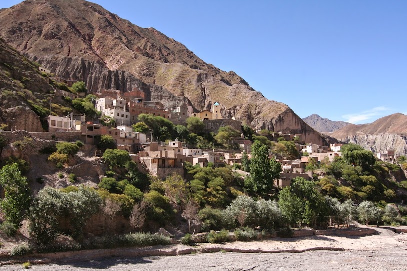
Humahuaca had a very Andean feel; they had llama empanadas and a much more indigenous population. Such a different experience than further south near Buenos Aires, where almost everybody looks European, but it still feels familiar for us since we’ve been through Andean Peru and Ecuador. Women in skirts and sweaters, men with ponchos and huge gaucho (cowboy) hats, snippets of Quechua… I can’t say I exactly missed this Andean feel (and I’d better get used to it now we’re in Bolivia), but it’s kind of nice to feel like you’re in familiar territory.
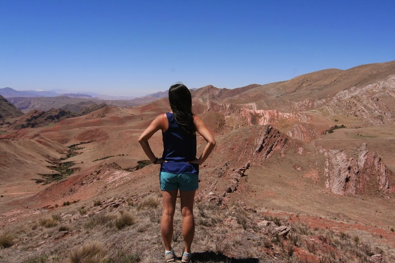
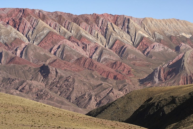
The highlight of of our time in Humahuaca was a trip out to the Sierras del Hornocal, a breathtaking rock formation about a 45 minutes’ drive from town. It can easily be done with a rental car, but since we didn’t have one at our disposal, we hired a truck to take us there. When it came, we were told we’d have to sit in the truck bed, since the cab would be full.

“Well, we get to pay less, right?” we asked indignantly. I have no problem with riding in the back of trucks anymore; nobody wears seat belts anyway and you just kind of hope everything will work out fine and you won’t end up squished on the side of a dirt road, but paying a lower price just makes sense. After sorting out the money issue (we saved about $4 USD by sitting in the back, woohoo!), we headed out. I can’t really describe the Hornocal–it was insanely beautiful–so just enjoy these pictures that Craig took. I wish we had left town about two hours before sunset so we could have gotten better light, but it was still worth all the trouble.
We then decided to head to the little town of Iruya, a rough three-hour drive over a 4,000 m (13,000 ft) pass called Abra del Cóndor, which had no condors, but was quite beautiful. Our guidebook describes it as “one of Argentina’s most amazing drives”, but… it was all right (maybe I’m jaded). Still, Iruya was a really cute town, despite none of its restaurants (none!!) opening for dinner until after 8pm. One of the joys of traveling that I won’t miss.

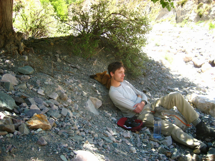
One day, we took a hike to San Isidro, an even smaller town 8km away. We heard it’s the only indigenous community in Northern Argentina that allows visitors (information not verified), but to be honest, Iruya didn’t feel all that much different. Craig and I also don’t feel like the trek itself is worth it after a certain point. Once you’ve followed the river bed to the end of the canyon in which Iruya is situated, and then turn left for about another kilometer or two, the views become uninspiring and mundane after that. So I’d just say turn around there, or explore the other side of the canyon; San Isidro is a long, dusty haul and even if I hadn’t slipped on a rock and fallen into the river, I probably still wouldn’t recommend hiking the whole way out there!
On the entire 16km hike, we had company in the form of Rolf, the stray dog (I named him). About 10 minutes into the trek, he found a dead, dried out carcass of something or other and proceeded to rub himself into it. So our dog-for-the-day then smelled awful for the rest of the trek, which was a considerably long time. Next time you entice a stray dog to follow you for seven hours, make sure he stays away from dead things.

By the time we made it back to Iruya, Rolf looked pretty beat. We were impressed with his stamina; and with all the running around he did, I’m sure he traveled at least twice as much distance as we did. We rewarded his loyalty with some of our packed sandwiches, and he seemed happy enough.

The border crossing into Bolivia was relatively uneventful, and I’m happy to say we crossed over with only about 37 Argentine peso ($3.70 USD), since the exchange rate is really terrible here. Nobody wants Argentine pesos, not even Argentines, and especially not any of its bordering countries.
So here we are… about to embark on a grand Bolivian adventure–the last country of our trip. Only six weeks left until we take a flight back to the U.S., where I will gorge myself on fake cheese and Ruffles. But there’s a lot to do in the meantime (including spending Christmas with a Bolivian family), so we’d better get to it!
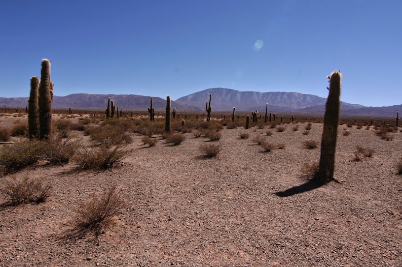
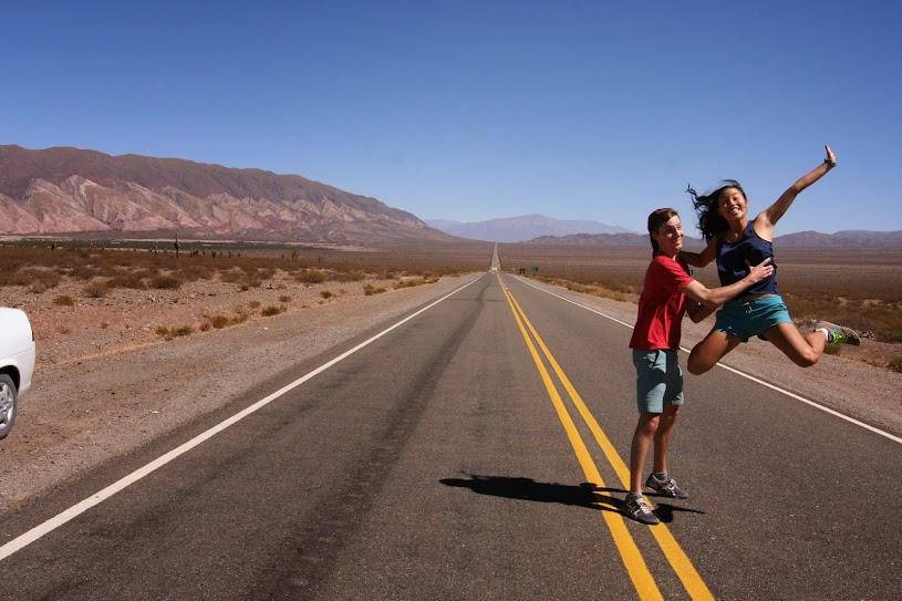
The fourth, and final day of our road trip was probably the shortest, and least exciting. We crossed the mountains from Cachi to Salta, spending the most time along a super straight section of road called the Recta de Tin-Tin, constructed on top of an ancient pre-Incan road. The hundred year-old cactus and surrounding flat landscape had us thinking about Wilie E Coyote and Roadrunner.