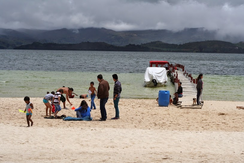
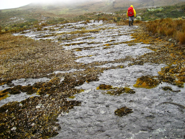
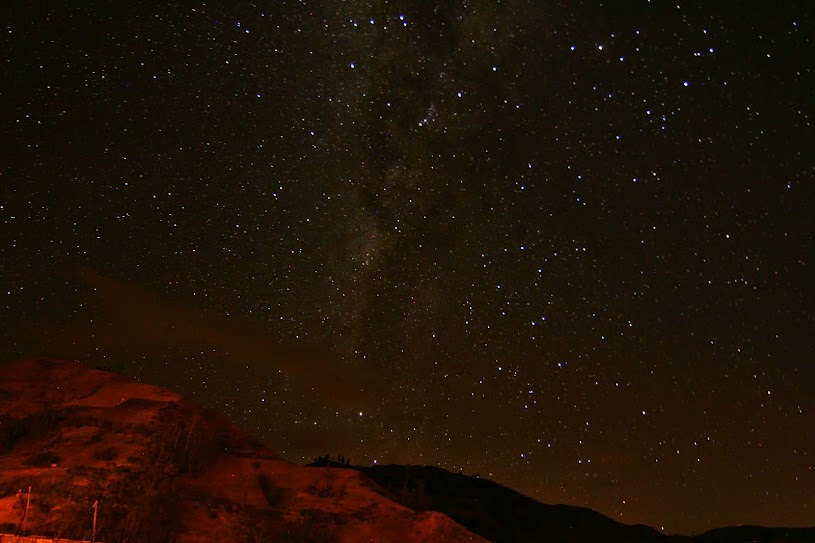
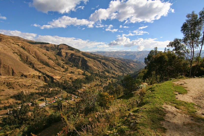
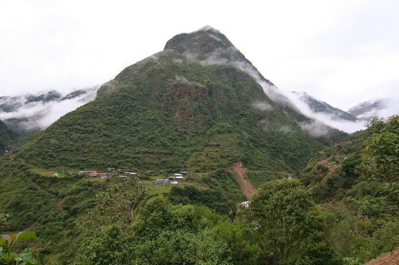
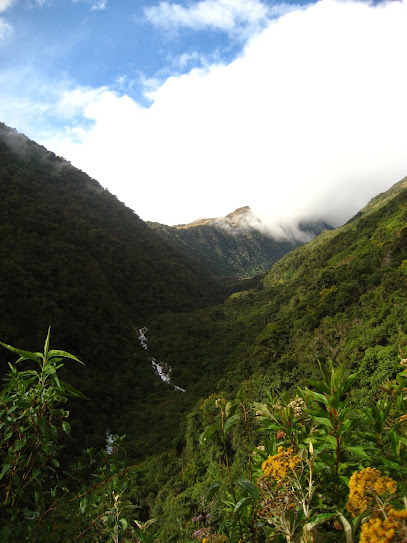
An alliterative description of our one-night backpack to Thornton Lakes in the North Cascades National Park.
Bees
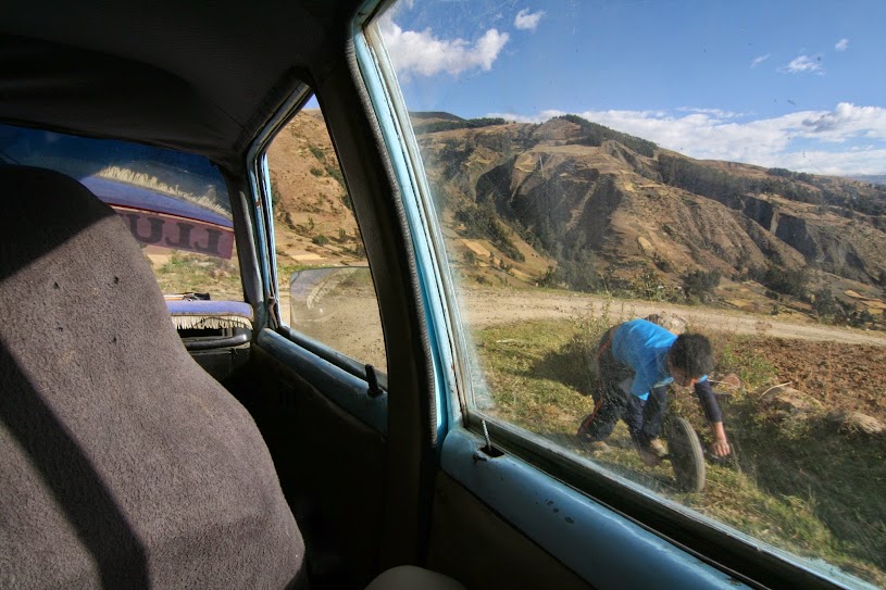
A dayhiker coming down told us to avoid the bees since he had disregarded the warning signs on the trail and walked through them, getting stung five times in the process. The signs looked very recent and there was orange hazard tape as well, but I’m not sure Craig or I would have made a detour if we hadn’t met that dayhiker. It’s so hard to do any extra work when you’re already doing the hard work of climbing up a mountain! We kept meeting people who had all gotten stung, so it’s funny to think of what people subject themselves to in order to avoid extra inconvenience when you’re already purposefully inconveniencing yourself. (Like trying to find the closest parking spot to the trailhead.)
We also heard one hiker complain that they were hornets and not bees. Would more people have heeded the signs if they said, “Hornets”?
Blueberries
Trail candy! There’s nothing better than reaching a certain elevation and finding ripe berries! It makes tired legs less tired and is a fun distraction from the pain.
Boots
We woke up the next morning to find that a critter had chewed off most of the leather on the tongue of Craig’s right boot, not to mention a lot of nibbles on the leather around the collar of the boot. After hauling up a bear canister and filling it conscientiously and even placing it 50 feet from our campsite, this felt like very cruel compensation for our efforts. At least Craig could still hike down in them, but now what to do for the rest of the summer?
A Bear
On our quick “jaunt” up to Trapper’s Peak, we encountered a small black bear. We yelled, clapped, banged my trekking poles together, and generally did all the things you’re supposed to do when you encounter a bear in the wild, including backing away slowly while still facing it when it came closer. Nothing deterred it from its blueberry breakfast, though, so we just had to wait until it had its fill and ambled off.
Hello there.
Blocked views
By the time we had hiked 2 hours down from Trapper’s Peak, it looked like the clouds had cleared and the view was probably a million times better than when we had been up there. Ah, the perverse luck of hiking up mountains.
The Picket Range should have been visible here. 🥲
A Bent pole
While taking the detour to avoid the bees on the way down, I slipped on a steep slope and could feel my pole bending underneath me. Curses, how much would this cost to fix/replace?? This hike was getting expensive.
A Break avoided
Craig slipped on some parallel logs and his boot got stuck in between them while he fell to the side. The awkward angle was such that if he hadn’t caught himself on some roots, he might have broken his ankle. As it was, he has some bruises and scrapes on his arm, but the ankle is fine.
But…
Was it worth it? I’m a lot less sore today than after our last one-nighter, when we went up 3,000ft in 3 miles. And I’m remembering again all of the tricks I did to stay warm at night (e.g. wrapping my down vest around my legs in my sleeping bag). We’ve been trying to get in shape, so hopefully we’ve now hit our stride because we’ve got a four-nighter coming up!
The day of departure dawns, but luckily you don’t have an obscenely early bus ride because it just takes 2.5 hours to get to Puerto Ibañez from Coyhaique and the only ferry on Tuesdays leaves at 8pm (only $2,500CLP pp, but advanced reservation required). Since the terminal was closed on Sundays, you had to reserve through Buses Carolina on Whatsapp, which is used for everything down here; hostel and bus reservations, tour questions, etc. etc. Because of the late departure, you can laze around the best hostel ever (Huella Patagónica) until it’s time to head to the bus terminal. The ferry docks in Chile Chico, and it’s a warm, balmy night as you walk the 1.5 miles to the hostel, Campamento Ñandu, whose owner Juan has been super helpful in answering about a thousand questions on email. You’re wearing your hiking clothes, which is a bit weird the day before the hike begins, but that’s the nature of a thru-hike; you gotta carry everything with you and so you’ve pared your pack down to just the essentials. Little do you know that you’ll end up wearing the same shirt for six days in a row; at this point you are blissfully ignorant of what is to come.
A scenic ferry ride at dusk.
The next morning, you set out for Reserva Jeinimeni in a private taxi (Garnik Bikes, reserved with Whatsapp, of course). It’s a 30-mile long dirt road to the park entrance and costs $25,000CLP per person. You’re trying to beat the bad weather that’s coming in roughly six days, so this is worth it. Patricio, the driver, is super nice and talks about the history of the park and even stops to pick some Calafate berries so you can try them. They’re blueberry-adjacent except that the plant is full of thorns and the fruit is full of seeds, but it’s nice to know what it is because you’ll be encountering a lot of it in the days to come. The weather is hot compared to what you’ve been experiencing in Patagonia so far, and Patricio explains that you’re on the other side of the Cordillera. It feels like you’ve just gone from western Washington to eastern Washington and everything is dry and brushy.
You check in and the park rangers are super impressed that you seem to know the route fairly well and that you’ve made reservations and that you’ve brought cash. Hell yeah, you’re so prepared. Give yourself a pat on the back. This is the last time you’ll feel so confident on the hike.
The first six miles is easy lakeside walking on an old road. Lago Jeinimeni is really beautiful and there’s no one on the trail (probably because the entrance is so far from Chile Chico). Soon, you get to the junction and the trail then becomes a find-the-stake game that crisscrosses the river bed. You wonder how many more times you’ll have to take your boots off, but if you knew in advance, it would be really depressing. Just do your best and think about how the alternative is to get your shoes wet and then have to wear bread bags over your socks at camp. Waterproof/neoprene socks paired with tevas could be a game changer.
Fresh as a daisy on Day 1 in front of Lago Jeinimeni.River crossings keep the feet cool on a hot day.
There is the most ridiculous pass to go over to get to Valle Hermoso that is basically straight up and down. As you descend at a literal 45-degree angle and your knees are crunching and your toes are going numb, you wonder to yourselves what Conaf has against switchbacks anyway. At least you get to see the amazing Laguna Verde the whole way down, which glows like a bright turquoise jewel. It is a welcome distraction from the pain. Near the bottom, you run into a Spaniard (Miguel) and a Hungarian (Istvan), two guys you saw on the Cerro Castillo hike (it’s always interesting who you end up seeing again on trips like this). They warn you about all the river crossings to come, not exactly something you want to hear when you’re on mile 9.
Numb toes? What numb toes?
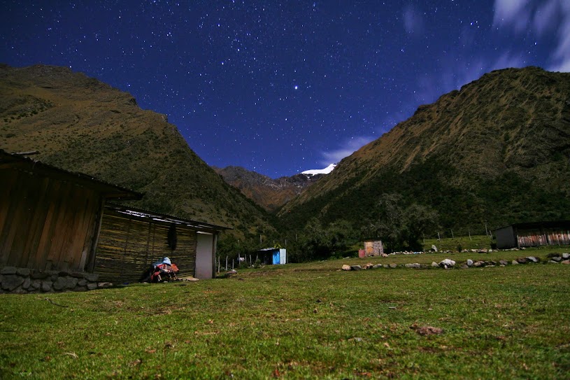
When you get down to the valley floor, there’s just one more river crossing before you get to the trail that leads to the Refugio where you set up camp. Phew! The European guys had said they didn’t see the Refugio, so did they lose the trail? You’ll find out the next day that it would be very easy to do. But you don’t have to think about that yet, Day 1 of 5 is done!
The next morning, you breakfast with a cute, young couple from Santiago who rolled into camp after dark last night when you were already in the tent. They’re only spending one night in the park, but it’s nice to have some breakfast company. They consume an awe-inspiring amount of bread that they burn on their camp stove (not sure if you can call it toasting), and you have a nice chat before heading out in opposite directions.
It’s more riverbed walking and stream fording and there are some detours through the brush to avoid having to take your boots off. You follow a cairn into the brush for one of these detours, but the trail peters out and you’re left pushing through the plant growth, all of which is poky and thorny. Stupid liar cairn! You feel like Prince Phillip from Sleeping Beauty fighting through the giant briar patch except you unfortunately don’t have a bigass sword, nor do you have three fairy godmothers. You just have a GPS app that isn’t helpful in predicting river crossings, but at least is useful in finding the trail again when you’ve lost it. One final, big river crossing that’s almost up to mid-thigh and you get to the climb up and over into Valle Avilés. You’re not home-free yet, though. There are so many more river crossings and finding-the-stake/cairn/stick games that you start to get pretty demoralized. It’s also hot as balls and the sweat is stinging your eyes. You wonder, not for the first time, what you’re doing with your life. On down the valley you go.
Beware this cairn of doom.The upper Valle Avilés with requisite river.One more demoralizing river crossing before camp.
You finally make it to the campsite, which is not as good as the campsite earlier on the trail, of course, but you make do and at least there are no mosquitos. The landscape seems to have changed yet again in this valley, with more pampa landscape. There’s nowhere to hang a bear bag, so you hope a hungry puma doesn’t wander through your camp.
Pampa in the foreground, Cerro Pintura in the background.
Day 3 is again a scorcher. The landscape gets increasingly drier, but the trail is in much better shape from this point on and there is thankfully no more frustrating way-finding. It’s a gradual downhill to Valle Chacabuco and what Craig so charmingly calls a “boot-swinging trail”. You have some fun on the suspension bridge 100 ft up from the river, but you don’t fully cross it because you’ve heard that trail is hillier than the western one. Anything to avoid a harder trail. A few miles further on, you meet two Chilean girls who are sweating uphill. They’re heading for Chile Chico and you try and warn them about the worst parts of the trail. They don’t have a GPS app and you hope they have a better time than you did in spite of that lack, but the airplane pillows strapped to the outside of their giant backpacks gives you doubt. They’re the first people you’ve met on the trail in over 24 hours.
Why do Indiana Jones movies always come to mind when crossing a suspension bridge in the middle of nowhere?“Boot swinging” trail in the pampa.
You can start to see Casa Piedra way off in the distance, which is where you’re hoping to hitch a ride to the Parque headquarters, 1.4 miles from the Westwinds campground. This would save 16.4 miles on the Carretera X-83, which, although really beautiful, is something you don’t have the extra food for. As Craig leaves you behind on the last mile to Casa Piedra, you wonder to yourself why he’s abandoning you. After fuming for a few minutes, you realize he’s probably trying to find a ride. If he succeeds, abandonment is completely pardonable. At Casa Piedra, there’s no time to appreciate a small herd of guanacos, the first time you’ve seen them on the hike, because Craig has indeed found a ride! This is a relief because finishing the hike as you’d originally planned hinged on being able to hitchhike.
Mike and Rina (hopefully I spelled that right) are a lovely (also interracial!) couple from San Francisco. They’re on their second trip to Chile in as many years because of COVID shenanigans. They did the rafting trip in Futaleufú last year, and had to come back for the Patagonia stuff. Getting a ride feels so luxurious, and it’s fun to meet some North Americans. There are so few of us down here! As you speed through the valley, you marvel at the beautiful landscape and the herds of guanacos. Not a bad walk if you have the time and provisions, but watch out for speeding cars! When you make it to the headquarters, more guanacos greet you. Are they brought in for the tourists, you wonder? Anything is possible in the pristine, brand-new complex of Parque Patagonia. It’s too bad it seems to be so little frequented. The campsite looks like it was built to hold hundreds of tents, but there are only six when you’re there. The hot showers are a pleasant surprise, but feels so strange in the middle of a hike. Is this glamping??
Just chilling by the parking lot.Peaks, peaks, and yes, more peaks from the Westwinds campsite.
You also learn that if you hadn’t found a Mike and Rina, there is a bus. There seems to be just one round trip per day on the Carretera X-83, and it’s quite expensive, but it’s at least a backup option. Of course there was no info on this bus anywhere on the Conaf website. That certainly would have saved you some pre-trek planning stress! You keep an eye out for the bus while you’re hanging out at camp, just for curiosity’s sake, but either it’s very stealthy or it’s not quite as reliable as you’d hope.
You can always Whatsapp for more info.The quality of signs is a lot higher than the quality of the trails.
Day 4 is the big climbing day, as Adventure Alan puts it. 3,000 ft in 5 miles is a totally doable elevation grade, though, and there are even switchbacks! Your legs thank whatever trail designer did not just place the trail on the most direct route up. Near the top, the wind picks up and the weather seems to be turning. You wonder which peaks aren’t visible through the clouds, but it’s nice not to be burning hot on the climb. The Chacabuco valley is so wide that you continue to see Westwinds way down below until you cross El Paso de los Condores into Sector Tamango. No condors in sight, unfortunately, but the views are nonetheless very nice.
Goodbye, Chacabuco.Wind-swept Paso Cóndores.
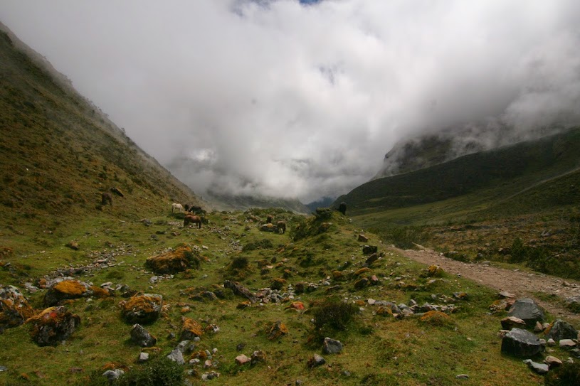
It’s a quick jaunt down to Laguna El Cangrejo, where the campsite is located. The weather has definitely taken a turn for the worse and the mood dips with it. As you sit in the rain, forearms burning from slowly squeeze-filtering water from the lake at an agonizing rate of 1 liter every 5 minutes, the tension and unhappiness is palpable in the air. “No more camping?” says Craig. “No more camping,” you agree. You still have one more night to get through, though, and it’s still quite early. Wearily, you climb into the tent to wait out the rain. The prevailing feeling at the moment is dismal exhaustion.
After staring at the tent walls for awhile, you hear voices coming up the trail. It sounds like they’ve stopped and are setting up camp right next to you. “Should we go out and be social?” you wonder. “Ugh, no,” says Craig, who forgets sometimes that he doesn’t hate everyone. You eventually decide to go out and meet your new neighbors. They’re a fun, hodgepodge group who have come together after meeting on a trek further south. A Canadian girl, Gabby, an English couple, Helen and Craig (yes, another one!), and a Scots-American couple (Caro and Ali); they’re planning on doing your trek in reverse and without taxis or hitchhikes. They’re all pretty hardcore and have been trekking way longer than you have, but seem to be in much better spirits about it all. Helen and Craig are doing the Greater Patagonian Trail (GPT), which you’ve never heard of, but seems intense. Three months of Patagonian backpacking, yowza! You decide you’ll never be young enough again to attempt that, but it’s fun to hear about. As you get to know each other and cook dinner, the sun comes out and the light is beautiful on the lake. You marvel at the 20-lb sack of food that Helen and Craig have. Five pounds of it seems to be dulce de leche alone. You also learn that they, unlike you, have attempted to send their non-camping stuff onwards to Chile Chico. You get all of their contact info, partly because you really want to know if that worked. Thank god for the injection of socialization; it’s really saving the trip, although you wonder later if some of the things you said sounded as asinine in the present as they do in hindsight. You suppose that’s what a pandemic and an isolated trail can do to your conversational skills. Ah well, life is too short to worry about stuff like that.
An evening gathering at the picnic table.
It’s a lazy morning on Day 5 since you only have 7 miles to get to the bottom of the trail. You bid farewell to the others after some selvesies, and you head off downhill. There follows some more knee-crunching, but you’ve had worse, and the end is in sight! It’s again blisteringly hot, and the sun reflects off the rooftops of Cochrane in the distance. You make it down to the road in just a few hours. After eating lunch at the park ranger building, you catch a ride into town from a taxi bringing in day hikers (although the ranger also offered to call one for you). It’s 2.7 miles and totally worth the 3,000CLP to your hostel. You can’t check in yet, so you head to the bus terminal to see about transportation back to Coyhaique the next day. After stopping for ice cream, you run into Miguel and Istvan again! How funny. They’ve come back to Cochrane for all of their stuff. You find out they’re on vacation, but usually they work for a tour operation called Backroads, which you’ve never heard of because it costs about $1,000USD per person per day for their trips. No wonder it’s not on your radar. They make a joke about how if they were leading a tour for work, they would never be standing for five hours on the road trying to hitchhike, nor would they be wondering if they can afford to have an ice cream. The different ways people travel is definitely a big contrast in places like this.
Cochrane, like most Patagonian towns, is surrounded by peaks.
When you get to the bus terminal, you learn the one bus to Coyhaique the next day is full. The girl at the desk says, however, that there are six reservations that haven’t been paid, and if you come back at 4pm, they will release them for sale. After a quick shower, you pull out the hiking shirt you’ve been saving so that you don’t have to wear a filthy, sweat-soaked garment on the journey back to Coyhaique. Ahh, bliss. Back and forth to the terminal again and you have bus tickets in hand. Another sigh of relief, phew! You high-five each other for the win. Cochrane is tiny and sleepy and staying two nights there isn’t ideal.
The bus is butt-early in the morning and when you get to the terminal, there are a lot of bleary-eyed, hopeful travelers without tickets waiting to see if there will be room for them. You see several backpackers that you recognize from your sojourns to and from the terminal yesterday. Why didn’t they buy the released tickets like you did? It’s situations like this that you’re extra glad you speak Spanish, as that seems to be the only discernible reason for why they’re left behind and you’re safely on your way.
It’s a long, long, looooong journey on mostly dirt roads back to Coyhaique. It’s only 200 miles but it takes 8.5 hours and there are just two bathroom breaks. You and your bladder are pretty wrecked by the time you finally make it back to cozy Huella Patagónica, but don’t worry, you’re just one hot shower away from feeling normal again. It’s taken you one week to bus, ferry, taxi, and hike to Cochrane and one day to bus back to Coyhaique. You’ve met a lot of cool people and you can now put your backpacking stuff away. Congrats, you did it! No more camping! (At least for now…)
Those are some smelly shirts at the beginning of Day 4.
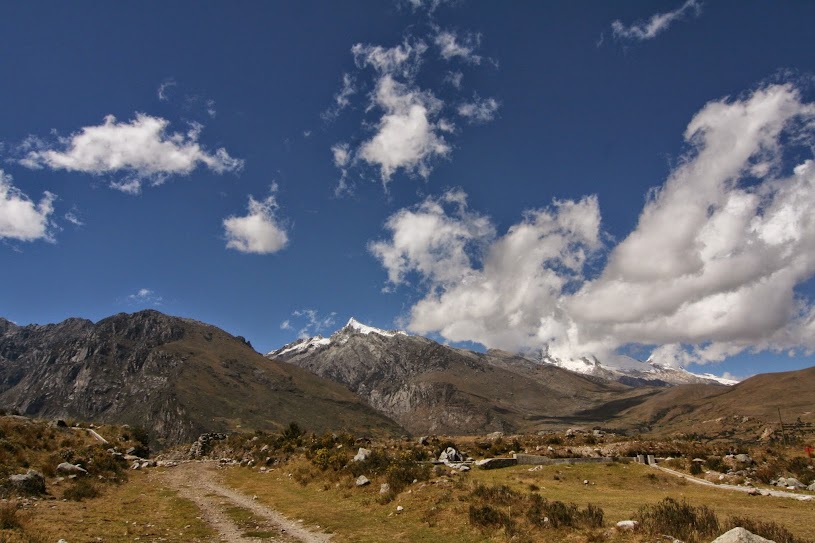
We’re currently in a little town on the Carretera Austral called Villa Cerro Castillo, camping at Nordic Patagonia Camping and Hostel, whose astonishingly lush grass lawn is magically cleaning the grime off our equipment. This was supposed to be our third night in Parque Nacional Cerro Castillo, but don’t worry, this isn’t going to be another doom and gloom post about what went wrong on the hike. It was actually a pretty great trek with amazing views!
Sneak peak of Cerro Castillo on the way up.
After changing our plans half a dozen times and modifying our hostel reservations (four times at Huella Patagónica in Coyhaique alone!), we finally set out on the bus from Coyhaique to Villa Cerro Castillo. There are a couple of bus companies that go this route and they can drop you off at Las Horquetas trailhead (buses going to Puerto Ibañez can also), about 30 minutes north of Villa Cerro Castillo, and you can do the trek as we had originally planned to do per Adventure Alan, southward through the park. Since Las Horquetas was closed on our Day 1, we took the bus all the way to Villa Cerro Castillo in order to do the trek in reverse in the hope that the section between Campamento Bosque and the Las Horquetas trailhead would open by the time we got there on the third day. It was insanely hard to get any clear idea whether or not it would open by then. The Conaf website said Thursday, which was definitely wrong, then we heard from the park service Saturday, then we heard maybe not from the rangers at the entrance. It was the central, persistent mystery of the whole hike and what made it so difficult to plan for.
Nevertheless, we set out in good spirits, mostly because we had figured out the whole how-to-bring-our-beloved-freeze-dried-meals-on-the-next-hike-problem. It was a long walk on a dirt road from town to our trailhead at Acceso Estero Parado, despite being able to hitch a ride in the back of a pickup for a couple of kilometers. By the time we got to the entrance, I’d asked Craig about five times how long the road was and how long we had left. He was not amused. Especially because I had failed to download the correct map on the GPS app. Whoopsies. Finally we got on an actual trail, which went over some stiles since the park is still surrounded by private lands, and we started hiking up… and up… and up!
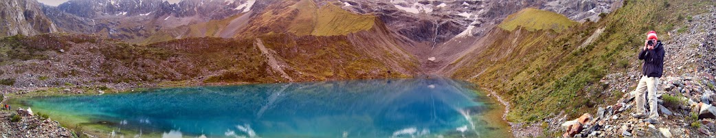
From the town to our campsite at Neozelandés, it was 8.9 miles and 3000 ft elevation gain. After setting up camp, we decided to go to Laguna Duff, only 1.6 miles away, but another 1000 ft elevation gain. The trail was pretty steep, and a lot of it required following cairns on rocky terrain, which was so not fun after the slog we had already done that Craig literally threw up when we got to the Laguna (it was probably the provolone he ate at lunch, though). I didn’t partake of the provolone so felt fine gastrically, but while we were resting on the trail, I actually fell asleep while lying on two rocks. That is saying something.
Laguna Duff. Was it worth it?
When we got there and were gazing at the majestic lake and its accompanying so-very-Patagonia peak with glacier, I asked Craig, “Well? Was it worth it?”
“Ugh, don’t ask me that right now,” he replied.
Thankfully, the hike back to camp was much better, and Craig was feeling mostly back to normal. Although the sun sets at about 9:30pm as far south as we are, it gets cold in a hurry and I was supremely thankful I didn’t make the stupid decision of leaving my new down pants at home (I had kind of bought them for this trip but waffled on bringing them because of their weight). Man oh man, those pants are a freaking GAME CHANGER. I was so warm and toasty while doing camp chores, and then I really had to wear them to be warm enough to sleep, despite having never before had a problem with being cold in my current setup in the States, even when we’ve camped in temps that have gone below freezing. There’s something about Patagonia cold that is soextra.
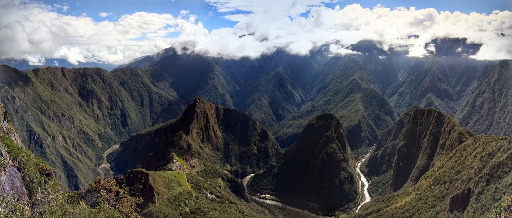
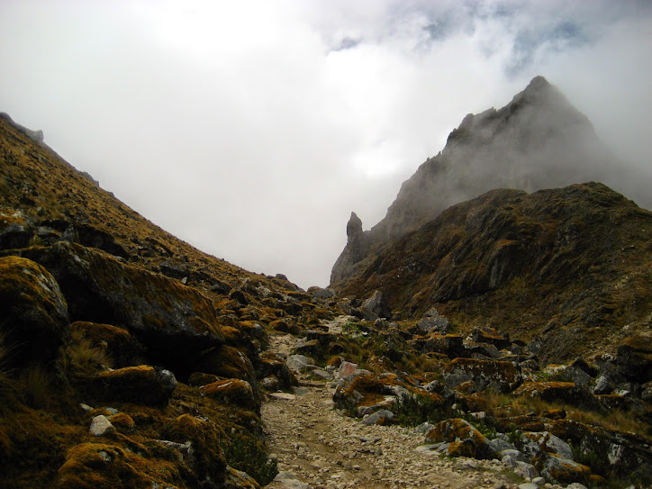
The next day, we backtracked down to Campamento Porteadores where the junction was, and turned towards the really daunting climb up and over Morro Negro. We again felt like we were dying (all that walking and hiking we did in Riverside in the three-week run-up doesn’t feel like it did anything), and there were about five million false summits, but we finally crested the peak. There, we met a fun Israeli couple who said their term for a false summit was “liar pass”, which I found apt and funny. Morro Negro was a debilitating 3000 ft climb in 2 miles over rocky terrain, following cairns and stakes. Brutal. Adventure Alan, who we cursed as a sandbagger the whole way, described it (in reverse) thusly: “steep and rocky and if the wind is up, the going can be a bit challenging.” We felt this did not even get close to adequately describing how freaking hard it was. Probably Adventure Alan eats hikes like this for breakfast and we’re a couple of weenies, but that was seriously one of the hardest hiking days we’ve ever done (and we do a lot of hiking!). We were so tired and sore at the top, but we still had to descend 2000 ft in less than 3 miles to get to Campamento El Bosque. The killer views made it slightly less painful.
Heading up Morro Negro. Not a happy camper.Finally getting a view of Laguna Cerro Castillo after making it over the high point. What a dramatic landscape!
Once up there, we descended a bit to the saddle and found a ton of day hikers. Their trail is also very steep, but at least it’s an actual trail and not a scramble. We trudged past and started our descent, taking in the magnificent Cerro Castillo, as well as the other beautiful peaks in the area. We were surrounded by crags and glaciers as we went.
This peak is not even the main attraction.
Once at camp, we had the good fortune to share it with some fun people; the Israeli couple, Shay and Yuval, a Québécois couple, Samuel and Justine, and another American, Harry. All of them were in the area to do lots of trekking, and we had a good time talking about all of the hikes. It sounded like prices had soared exponentially since we had done Torres del Paine. I recall paying only about $5,000CLP max for a campsite during our O-Circuit trek in 2014, and Craig remembers not having to pay for campsites at all in 2008. Shay told us it was now $50,000CLP per site, although I’m sure much cheaper for Chileans, who have a lot of pride and patrimonial feelings towards these natural treasures. Most Chileans we’ve met have been to at least some part of Patagonia.
This was also the crucial night in which we made the decision on how to finish the trek. Go back the way we came to Campamento Porteadores? Heck no were we going to do that climb again. Hike back up to the lookout at Laguna Cerro Castillo and follow all the day hikers out? Or keep going on the traverse to the Las Horquetas trailhead? After talking it over with a ranger who was at the camp to start repair work on the bridge that was out (the reason for the trail closure), we decided to hike out in the day hike trail. It would mean only two nights in the park, but we could camp in town on the third night and have an easier morning without having to rush out 6 miles and 5,000 ft elevation gain and loss to make the 12:00pm bus back to Coyhaique. The ranger thought that we’d have to leave camp at 5:30am if we wanted to be sure of not missing the bus.
So, because we’re trying to be kind to ourselves, we hiked back to Villa Cerro Castillo the next day. Before we headed out, though, we ran up to the lake about 0.6 miles away from camp. The Israelis had done it the night before and when we asked them about it, they said, “You mean the lake that has a mountain and a glacier? You know… it’s kind of like all the other lakes with a mountain and a glacier that we’ve seen. Not even in the top ten.” They’ve obviously been doing a lot of hiking already (Fitz Roy and Las Torres being two examples), but it was pretty funny that they were so-so on what Craig and I thought was a really beautiful scene.
Just another mountain+lake+glacier combo. When you’ve seen one, you’ve seen them all. (I couldn’t even figure out the name of this lake.)
Our last day was a lot sunnier and it’s been interesting to compare photos from both days since we had more clouds coming over Morro Negro. It’s kind of nuts that this view can be had with just a day hike and $19,000CLP per person (about $20USD). Craig remarked that he thought there might be something like this in the North Cascades, but it certainly wouldn’t be accessible to the masses the way Laguna Cerro Castillo was. I think that’s what’s so cool about Patagonia. There are these amazing peaks and views that are very accessible to someone who doesn’t even have a car. And they’re all very close to sea level, so altitude sickness isn’t really a thing you need to worry about. Maybe the Alps are similar? We’ll find out someday…
Shay and Yuval at least did say Laguna Cerro Castillo was in their top five.
We found out on our way down that the Ruta de emergencia that Adventure Alan gives as an optional out is actually now closed. I suppose this is what we get for following a blog post that’s 4 years old. Still, the other trail down is also beautiful and the views of the Rio Ibáñez valley were just incredible.
Preeeettyyyyy.
Our minds are now turning towards our second and final trek in Jeinimeni and Parque Patagonia. Hopefully the weather (and our bodies) hold up for the next adventure!
After sweltering away on the Caribbean coast, and experiencing some warm weather even in San Gil, Villa de Leyva and Sogamoso have felt nice and fresh. I suppose the Seattle in us just can’t handle the heat too well.
Sogamoso isn’t a very pretty city, but it’s next to the El Cocuy national park and the Páramo de Ocetá, a type of moorland that is only found in South America. We haven’t done much nature stuff since we arrived in Colombia, so Craig and I decided to bust out our hiking boots (which are always packed at the very bottom of our backpacks–such a pain) and get into nature.
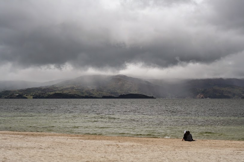
But first! A trip to Lago Tota, the largest and highest lake in Colombia. Mostly surrounded by small villages and green onion farms, it also boasts a white sand beach and a MONSTER! I’m sorry to report that we weren’t able to glimpse this awesome creature, but the lake was very pretty.
Canoodling couple on Playa Blanca, Lago Tota.
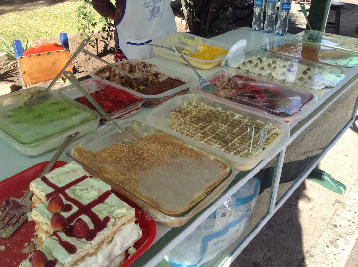
We then headed towards Iza to partake in some thermal baths–our fifth hot springs of the trip. Piscina Erika wasn’t the best so far, but it wasn’t bad, as long as you don’t mind smelling like rotten egg for awhile afterwards. We closed our day with some delicious pudding from one of several vendors in the town square. When I asked what they were called, the woman answered, “Deliciosos postres,” which just translates into “Delicious desserts”. I wasn’t sure what to make of it, but they were very yummy.
Puddings! Craig and I got two flavors–blackberry and passionfruit. They were indeed delicious; just watch out for the bees.
The next day, we set out on a hike with our very own guide–a first for us. Miguel was also the owner of our hostel and I’d guess in his fifties. We panted up to about 3,800 m (12,400 ft), but this time at least, we didn’t feel the effects of the altitude much. Not sure what the difference was between this and other, not so great times we’ve had with altitude, but we were thankful. Despite being twice our age, Miguel set a pretty blistering pace with almost no breaks. When we finally reached the viewpoint, everything was completely fogged in and there wasn’t much to see. Miguel looked at his watch and exclaimed, “Wow, we’re early!” Craig and I wished we hadn’t woken up at 5:45am when he said that.
What we saw.
What everybody else sees. Cue tragic violin music.
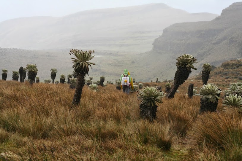
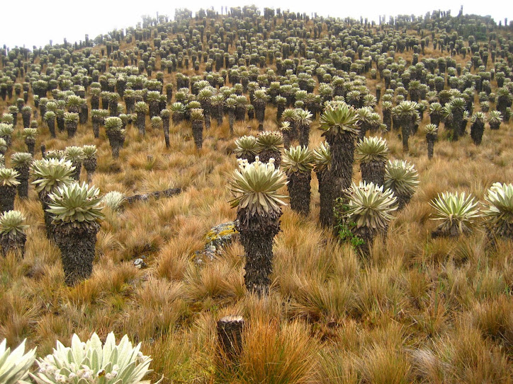
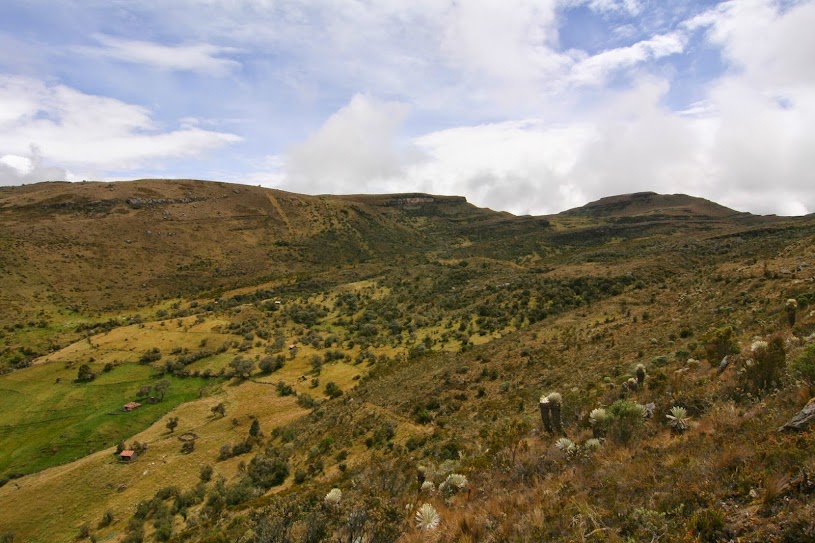
The fog cleared for a nanosecond–enough to glimpse Lago Negro way down below, but the weather decided to take a turn for the worse then and we hiked back to Monguí in almost a steady drizzle. Craig and I have definitely gotten our fill of Seattle-like weather now, and I’ve also become aware that my boots are no longer waterproof. (Hiking through rain in a marshy wetland is a good way to test this if you’re unsure, by the way.) Still, the Páramo was very beautiful when the fog lifted enough for us to see it. It’s filled with Frailejón, a funny-looking species of plant that only grows 1 cm per year, according to Miguel. Thus, some of the frailejón we saw would have been 300+ years old.
The frailejón is only found in páramos, which are only found in northern South America.
Brief spurt of good weather. Really beautiful–we’d heard it was one of the most beautiful places in Colombia. I think we would have agreed with this more if we hadn’t been soaked with rain.
Miguel finally having a rest. That guy was a machine.
Be careful what you wish for–lots of cold and rain.
We’ve been on several hikes this trip where guides have seemed completely unnecessary (Glacier, Colca, Salkantay), but the Páramo is not very well-marked. It would also be a desolate place to get lost in. It’s doable without a guide, but I would say only for very experienced trekkers and maybe if you have a GPS. The trail gets lost several times on the way, and if you go the wrong way, rivers have to be forded, etc. Not much fun. It’s not the most difficult hike we’ve done, but it was definitely the wettest. I’m glad for our cozy hostel (Cazihita), since the rain is still pouring down outside.
Our next stop is Bogotá, where the forecast is for lots of rain as well. After six soggy days there, we’ll fly to Buenos Aires–yahoo! It looks like it’ll be nice, spring weather when we get there. We’re looking forward to Bogotá nonetheless… but I sure wish I had my rain boots here!
Eager to stretch our legs (or at least I was), we took our guidebook’s recommendation and started off on the Quilotoa Circuit from Latacunga. Very similar to Colca Canyon in southern Peru, this circuit involves hiking relatively short distances (10-12 km) between small towns in the gorgeous Rio Toachi Valley. In typical fashion, our trip started off with a hitch, as it appeared that the 9:30 am bus to Quilotoa Crater left about 20 minutes early… after waiting an extra hour, and meeting a super nice Colombian couple, we were off. Even though our bus was very clearly labeled “quilotoa”, we were unceremoniously kicked off at Zumbahua, and told to get into a pick up truck which would take us the remaining 20 minutes. It was a tough squeeze, but we managed to get about 20 people into this truck. Victor, one half of the Colombian couple, laughed it off as typical “latin disorganization.” He informed us that we wouldn’t get a break from it further north either.
Volcan Cotopaxi from our hostel in Latacunga
On the truck ride we met an 18-year old German girl who didn’t know much about Quilotoa, she just thought it sounded like a nice destination. Not at all prepared for the freezing temperatures up at the crater (4,000 meters) she was easily convinced that it was a poor idea to stay the night at the top… we invited her to join us on the hike down to Chugchilán, but not without a sense of foreboding (see the infamous ‘bob’ episode). Merit turned out to be pleasant company for most of the time we were together, but we did have to make certain “allowances” for her age.. would we have been like this traveling at 18? Honestly, I can’t imagine undertaking a trip like hers at that age.
Quilotoa Crater
The route to Chugchilán wasn’t clearly marked, but with the end destination mostly in view, we managed to get ourselves to the Cloud Forest Hostel before dark. The hot shower and filling meal were amazing, but really the accommodation on the whole was way above expectations. You don’t expect to have a private bathroom, dinner and breakfast for only $12 per person, even in middle-of-nowhere Ecuador, but that’s exactly what we got!
Hiking out of the Rio Toachi Valley
Merit caught a 4 am bus back to Latacunga, so we were on our own for the second day of hiking. Another 11+ km to reach Isinliví, and another descent and ascent into the Rio Toachi valley. The weather was nearly perfect on this day and we really took our time, stopping often to soak in the scenery. The general feel of the trek had us thinking of Colca Canyon a lot, but the countryside was more similar to the Sacred Valley of the Incas. In Baños, we had met a Catalan/French couple who called off extra days on the circuit after hiking this portion, because “the scenery was too similar to Colombia and we were tired of it.” As baffling as that is, I guess it makes me pretty excited for Colombia!
Getting ready to descend into the valley again – speaking with a nice local at the viewpoint
With plans to stay in a certain hostel in Isinliví, we were told en route that the Tiata Cristobal was equally great and much cheaper ($13 per person), which made our decision to switch pretty easy. We ended up being the only guests that night, and enjoyed an incredibly nice dinner and evening next to the wood burning stove, a private room and bathroom and an equally great breakfast. Since no one was there (and the town seemed pretty quiet in general), we asked if it was low season. Our host said no, that tourism in general had been down this summer, and that she blames the World Cup in Brazil.
The view from Taita Cristobal
The best news we received in Isinliví was that the bus back to Latacunga on Wednesdays left at 7 am! We had been told it would be a 4:30 am departure so this was just perfect news. The bus ride also turned out to be one of the most scenic I’ve ever been on. We climbed for 45 minutes to reach the Paso de Guingopana, leaving the morning sun-soaked Rio Toachi valley, and were greeted with stunning views of Volcan Rumiñahui and Cotopaxi. No pictures of that journey here (the camera was under the bus), but I’ll leave you with one from the previous night.
On our last day in Huaraz, we decided to hike up to Lake Wilkacocha. In retrospect, we should have done this one earlier, as it was much better suited for acclimatization than our other choice. I guess now we know a little better and will be better prepared next time.
After two nights in Huaraz (10,000 ft in elevation), I thought we were acclimatized enough to attempt a day hike to nearby Laguna Churup (14,600 feet). Surely all of that time in Cusco would help us get used to the elevation quicker, right? We took a combi to the village of Llupa (11,800 feet), and begin to hike towards Pitec and the entrance to the Huascaran National Park.
On the road to Pitec. Nevado Churup in the distance.
The hike between Llupa and Pitec was stunning. The peaks of the Cordillera Blanca loom overhead and I was overflowing with happiness to be in such a beautiful place. We passed by families harvesting potatoes, and others shepherding their small herds of cows and sheep up and down the road. After a short break at the entrance to the national park (12,450 feet), we started the real climbing, and it was only shortly after we had payed our S./20 ($7.50 USD) entrance fee that I began to think I wasn’t going to make it.
Looking south from the entrance to Huascaran National Park.
Altitude sickness has a way of sneaking up on you. Initially, I just felt very lightheaded, and short of breath. Both of these things are pretty normal when hiking at altitude, and they were things we experienced while on the Salkantay trek. But at some point I had some pretty extreme muscle fatigue set in, and then my lightheaded-ness started to turn into a headache. The elephant sitting on my chest was only growing heavier. We passed some other trekkers at about 13,600 feet and were encouraged to learn that we only had about one hour and 1,000 more feet of elevation to go! It was shortly after this that I sat down on a rock and knew I could go no further.
Walking along a relatively flat part of the trail, close to my turning-back point.
Sheena decided to continue up the trail a bit further, hoping to get a closer shot of Nevado Churup. She was tired, but not feeling any of the affects of altitude sickness that I was. As I tried to wait for her to return, sitting in the middle of the trail, I realized that my symptoms were only getting worse. I quickly wrote a note for her, built a little cairn so that she wouldn’t miss it, and started descending as fast as I could.
“Amber waves of grain” and Nevado Churup.
Looking back down the valley. The beautiful scenery reminded me of both the Colca Canyon (only greener) and the Sacred Valley.
On the descent, we were fortunate to run across a taxi (or colectivo, since others would get in too) which could take us all the way back to Huaraz, thus avoiding the wait for a combi in Llupa. It turned out to be the loudest vehicle I have ever ridden in. The whole body shook violently with every ridge and pothole the road presented. The driver stuffed newspaper between the window glass and the car door to minimize the rattling. And even though this trip most likely resulted in my continued headache through the night, I sort of loved the randomness and uniqueness of the experience. Sheena waved back to every child we passed and we laughed at the small chickens, ducks, and dogs that ran for cover in front of us.
Rattling down the mountain road in Mi Rocio.
Altitude sickness can linger too, and I’m still feeling much less than 100% today. Sheena is actually feeling pretty sick as well. Perhaps the effects were only just delayed for her. Our only hope is that we can get over it, and plan some more hikes in the near future. The landscape is calling for me, and I badly want to go exploring.
Reaching Machu Picchu wasn’t easy. Our Salkantay trek was more of a mixed-bag than we had hoped for, but there were still some great things seen along the way. Sheena provided the gory details, so here are some pretty pictures for your enjoyment.
A stunning, full moon night in Soray Pampa. It was cold, cold, cold. We shared a twin-size bed to take advantage of body heat.
Exhausted, but not even half way to the Salktantay Pass on Day 2. The weather doesn’t get any better than this, and we enjoy the beautiful view back down the valley.
Over the pass on Day 2, and a break in the fog/rain allows us to enjoy our packed lunch.
Leaving Challuay on Day 3. The weather pretty much stayed just like this for the entire walk down to La Playa.
Looking up at Machu Picchu Mountain, from the railroad track, shortly outside of the Hidroelectrico site on the morning of Day 4.
Taken from the Machu Picchu site on the morning of Day 5. We were on our way to the Machu Picchu Mountain entrance gate.
After two hours of climbing old Incan stairs, we arrive at the summit of MP Mountain, about 1000 meters above the river. From this height you can really appreciate how hard it was for them to build this city, and what a stunning location it is.
This is the completely true story of how, after three and a half days of trekking, it came to be that I, a self-possessed, emotionally stable 30-year-old, could be found standing in the middle of a crowded trail, bawling my eyes out on Craig’s shoulder and sobbing uncontrollably, “I just want to go home!”
As we hiked up to Laguna Tucarhuay from Soraypampa, a glimpse of some nice weather. I suppose it wasn’t ALL rain and fog.
As Craig explained in an earlier post, our revised plan for Machu Picchu, one of the “new seven wonders of the world”, was to do a four-day trek to Aguas Calientes, the entry point for the national park.
There are only two ways to arrive in Aguas Calientes from Ollantaytambo, a town outside of Cusco. The first option is a 1.5 hour train ride (lowest price is $54 USD one-way). The second option is to first take a 6-hour bus ride along narrow cliff roads to Santa Teresa, followed by a 30-minute taxi ride to Hydro Electrico, and then hike 7.5 miles to Aguas Calientes along the Rio Urubamba (as low as $8-12 USD). The Salkantay trek would end in Santa Teresa, where we could then combine it with this second option to enter Aguas Calientes. Our plan was to also hike and bus our way back to Ollanta after Machu Picchu, in order to avoid paying for even a one-way ticket on the ridiculously high-priced train.
Laguna Tucarhuay and Craig.
I was very excited to do the trek since in its preceding days, as we were volunteering for the SAE, we got to see a lot of people come back from it, and they all had extremely positive things to say. It seemed within the range of difficulty that was acceptable to me, and we would be “glamping” again; staying in cabins along the way and having our meals provided to us, instead of having to carry tent, gear, and food. What could possibly go wrong?
Quite a lot, as it turns out.
Our first misstep was to agree to a third person joining us on the trek. We will call her Bob, since an apt analogy would be to compare her to the titular character of the classic Bill Murray film, “What About Bob?” I don’t remember much about that movie except for the unrelenting frustration and annoyance that Richard Dreyfuss felt, so that’s really the heart of the comparison… it obviously wasn’t physical!
More panoramas! Before the weather turned on the second day, from Soraypampa to Chaullay. 21km and going over the pass, which was at 4,600 meters. Oof!
Bob was female, an American, and a recent college grad traveling on her own who was going to do the trek through the same company as us. Since she didn’t want to do the hike by herself, she asked if she could join us and we, being nice, sympathetic people, agreed (to our ultimate regret… why do we Americans have to be so polite??). Unfortunately, Bob turned out to be one of that miserable variety of people who don’t appreciate the beauty of silence. No matter what was happening, she had to fill in the moment with conversation and pesky questions. “What do you think about this?” “Why are you doing that?” And my very least favorite of all: “What are you reading?”
Now, normally, a very talkative person is not a huge bother. They can usually be dismissed in some casual way or other. But on a hike of this nature, we were forced to spend nearly every minute of the day together–walking together, eating meals together, and sometimes, sharing a room together. You can’t very well relegate one person out of a group of only three to her own solitude, no matter how annoying she is. Because, after all, there is such a thing as manners (ugh!).
Foggy hiking is best accompanied by muffled silence, not non-stop talking.
And so, because climbing thousands of feet in elevation while gasping for breath due to the thin air was not bad enough, we had to also endure Bob’s inane musings throughout the long miles. Another black mark against Bob was that she thought she knew all there was to know about everything. If there’s anything that makes a Chatty Cathy worse, it’s if she’s also condescending, patronizing and eight years younger than you.
Woe is us!
Looking back at the pass, nearly arrived in Chaullay.
We managed to make it through the hardest bits of the hike, but arrived in Santa Teresa with a distinct feeling of disappointment. It had rained or was foggy for pretty much the entire time, and although the pass went through two glaciers, we unfortunately saw neither as our views were blocked by clouds. Aside from the wet and muddy conditions, the weather was also quite cold due to the elevation, despite moving closer to the equator… our first night I’m sure was in the 30s F. Brrr!
The only good things about doing the trek the way we did were 1) it was cheap, 2) mules and horses didn’t have to carry our gear (there were so many overburdened beasts on the trail… very sad), 3) the food was delicious and plentiful, and 4) we never had to pack up a wet tent.
This is what happens when you’re allergic to insect bites. Now you see why I complain so much.
I was really looking forward to the hot springs outside of Santa Teresa, but they were sadly tepid, and full of biting insects–yet another disappointment! I woke up on our fourth morning, muscles sore from the previous three days of difficult hiking, with several welts from whatever found my blood particularly delicious the day before, a tweaked ankle, and a swollen foot. Not having yet resigned myself to my fate as the holy grail of flesh for all insects, I resentfully reached for my pile of clothes only to shriek and drop them on the floor. Peering over the side of the bed, I ascertained that what I thought I saw was, in fact, real: they were covered in a swarm of tiny ants. There have been moments in my life, thankfully few, where I have felt that life is flat, stale, and unprofitable. That morning can be added to the short list.
Therefore, I was not in a good frame of mind for the 7.5 mile walk from Hydro Electrico to Aguas Calientes. In light of my fragile mental state, Craig braved the gods of etiquette and asked Bob if we could separate for the day. She, not being so thick-headed as to be ignorant of my black mood, graciously agreed. I wouldn’t be surprised if she was grateful for the escape! I’ll admit I was not a pleasant person to be around that day.
Third day, on the road from Chaullay to La Playa. More rain, as you can see. The mood had yet to go sour at this point.
Of course, it takes all kinds and I don’t usually feel the need to judge people too harshly, but after four days of incessant chattering, I was more than happy to send her on her way. So it was with extreme dismay that an hour into our hike, she somehow met up with us again, and in our subsequent five minute exchange, managed to make me feel even worse.
It’s hard to describe how and why emotions manage to overwhelm us. It was as if 72 hours of pent-up anger suddenly exploded out of me, which then unleashed a watershed of homesickness. I was tired, sore, and in pain. My already tenuous control over my feelings broke, and I found myself wishing for all sorts of impossible things: the hike to be over, to be by myself, to be comfortable…. in short, to be at home. But I don’t have a home anymore, and the estrangement I felt over that realization has still not quite dissipated.
The trail from Hydro Electrico to Aguas Calientes. There is one thing I will say for that day… it wasn’t raining! Just an outpour of hundreds of tourists. I think I prefer the rain!
I know that I can go back to the States at any time, but I don’t think I want to. I don’t want to give up on this adventure that was in the making for so long. So I’m crossing my fingers that it’s just a phase that will soon pass and allow me to rediscover the joys of traveling. After all, there will be Bobs and there will be rain and there will be mosquitos. I just hope they don’t all come at once again!
But we are now back in Cusco, settling in comfortably in our old digs at the SAE, laughing with our volunteer friends, and having a tiny bit of that feeling of coming back to something familiar and welcoming. It’s as close to home as I’ll get in a very long time, so for now at least, I’m appreciating life and the small pleasures it can give.
View from Machu Picchu Mountain. It was worth the 2-hour climb up Incan stairs. And we luckily had good weather for it!